Travels 3 - Hiking
|
By
the time we returned from our brief cruise, it was time to prepare, for our
next 'expedition'. Each year we have tried to spend some time in the South Island,
whether by boat or cycle or foot. This year was 'Routeburn Year'. After Milford,
the Routeburn Track, is probably the best known in New Zealand and is
generally thought to be more challenging and varied than its slightly more
famous rival. It is also common to hike one or other of the tracks, which
lead to the western end of the Routeburn. This means that the total time
spent on trails is usually five days. |
|
|
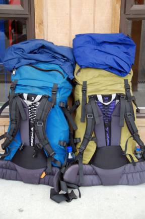
Those
wealthy enough to join the 'guided hikers' have most of their gear moved for
them between comfortable lodges where their food and drink is also provided.
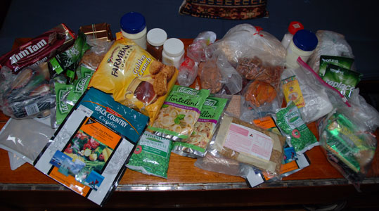
They carry only day packs. Those of us with fewer means and stronger backs –
'independent hikers' or 'smellies' – must carry all our food, clothing and
equipment for five days in our sacks. It amounts to a fair weight, which
fortunately declines as the days go on. |
|
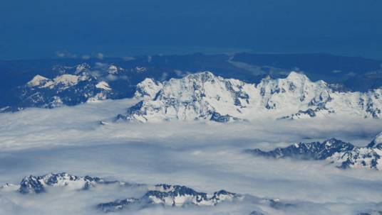
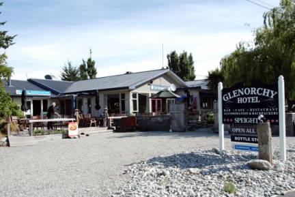
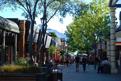
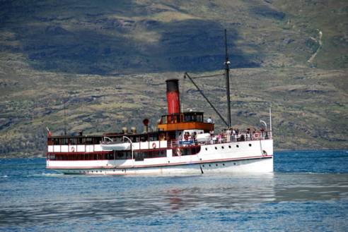
The
flight to Queenstown, gave us a wonderful view of the Southern Alps, still
heavily laden with snow even in mid-summer. We
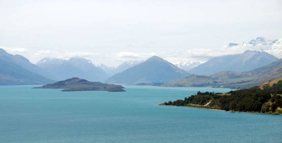
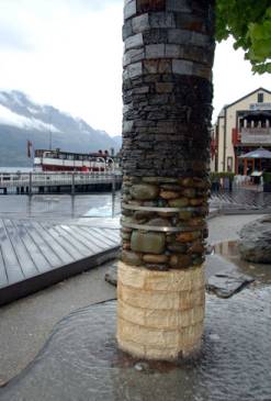
had no particular desire to spend time in Queenstown, which has a beautiful
setting but a rather tacky, touristy atmosphere. We headed instead for
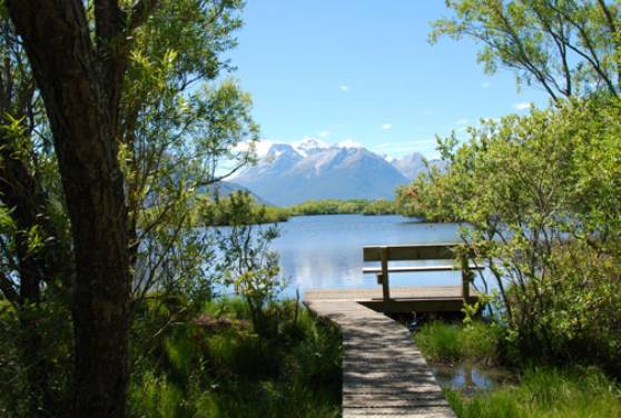
Glenorchy, a village at the head of lake Wakatipu, from where we could
explore the countryside. The village has a spectacular setting and some
quaint features like it's tiny library, left over from an earlier age. It is
a family holiday spot as well as a jumping off point for those, like us
hiking the trails that criss-cross the local hills and valleys. |
|
|
|
|

|
|
|
|
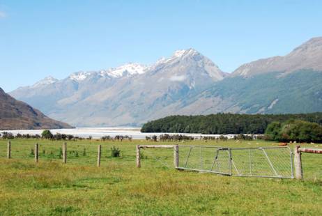
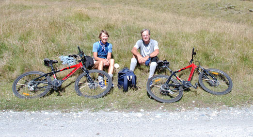
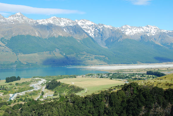
At
the hotel we were able to hire mountain bikes and took a 60 km ride up the
valley of the Dart, past the well named Paradise as far as Chinaman's Bluff. The
ride was not especially challenging, as the first part is on paved roads,
followed by a long stretch on well-maintained and graded gravel. What is more
we were lucky with the weather, so that the only thing slowing us down was
the need to stop regularly for Vicky's photo-ops. |
|
|
|

|
|
|
|
|
|
|
|
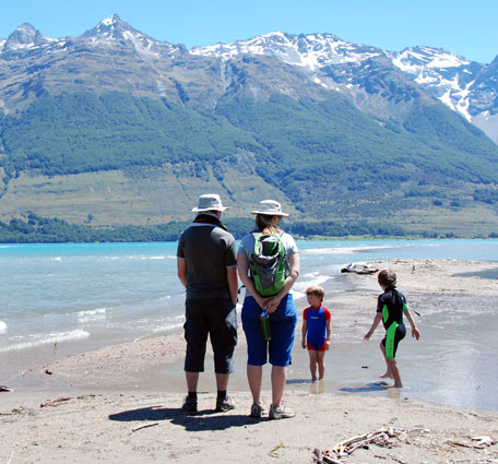
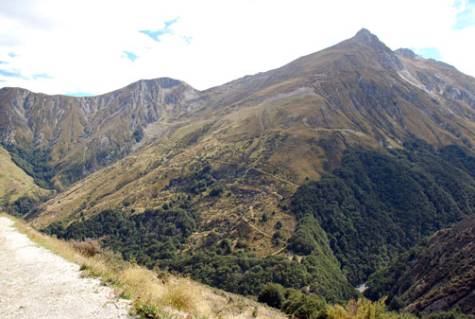
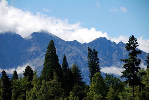
As
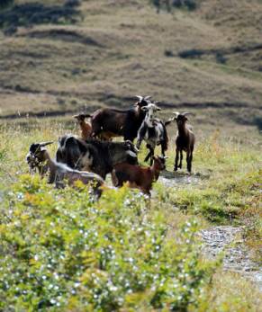
a further attempt to get in shape for the longer hike to come we also managed
a day hike from the village into the range which bounds the Lake on its southern
side. In the clear mountain air we had wonderful views over the lake and the
valley, getting high enough to meet a flock of goats which were only slightly
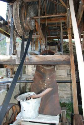
resentful of our intrusion. The area was at one time mined for scheelite, a
mineral used primarily in arms manufacture. Not surprisingly it made
Glenorchy something of a boom town during the two world wars, but with bust
times in between. There were still the remnants of mining activity left
behind on the steep hills above the deep valleys. |
|
|
|
|
|
|
|
|
|
|
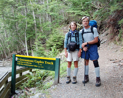
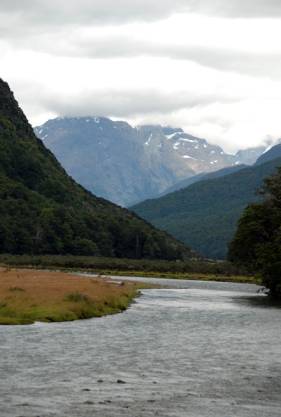
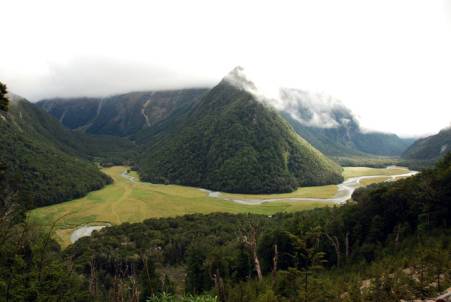
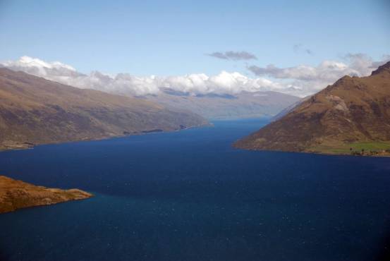
From
Glenorchy, it is possible to take a boat across the Lake to the start of the
Greenstone/Capel tracks, which divide a little further on, the Greenstone taking
the easier, but longer route up the valley to the west and the Capel the
shorter but tougher route to the east. Naturally, Vicky had chosen the Capel
as our preferred route! Initially both tracks follow the Greenstone River, a meandering
stream in a flat valley bottom. We
then followed the glacial Caples River, which at times was a torrent running
through a steep gorge. |
|
|
|
|
|
|
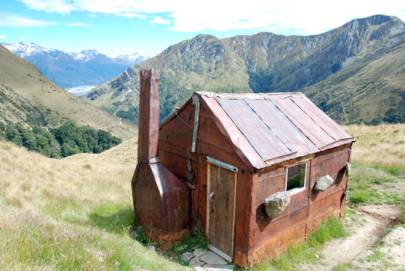
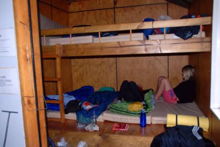
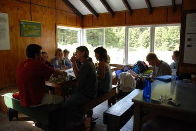
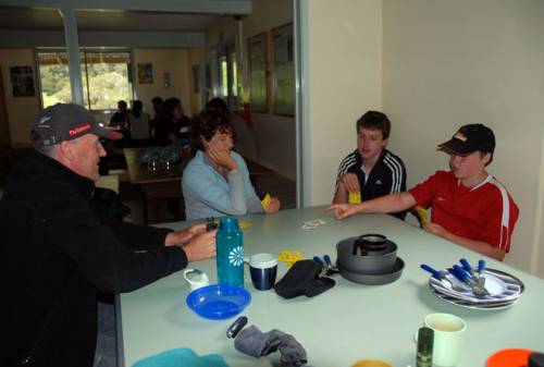
The
DOC (Department of Conservation) huts along the way are basic, but adequate,
with sardine-can mattress bunks and rain-water supplied sinks. Though there
are cooking facilities in the Routeburn huts, you have to carry your own
stove on the other tracks. During the high, summer season the huts are
crowded, but it is remarkable how well everyone gets along and cooperates. |
|
|
|
|
|
|
|
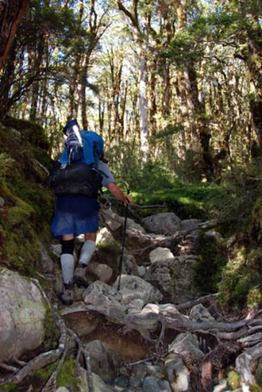
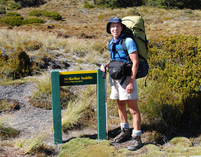
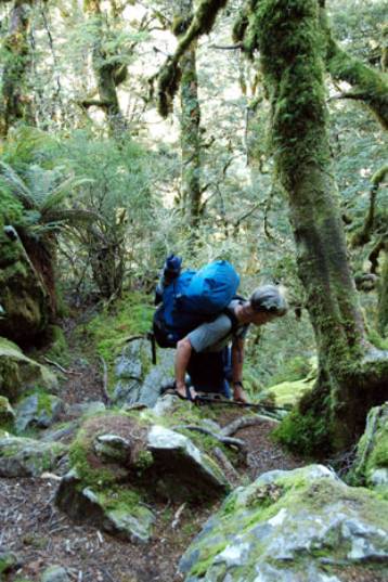
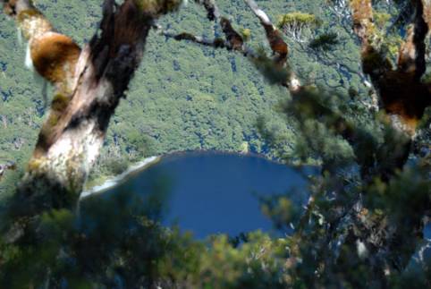
After
the first night at the Upper Caples hut, we had a steady, increasingly steep
climb through bush up to the McKellar Saddle, where moorland briefly takes over
– until you look down the other side! The descent from the saddle to McKellar
Lake below is extremely steep, so steep that there are times when it might
seem simpler to swing down from the trees – if the path were not so winding
and irregular. It was certainly a challenge for aged knees and relief to
reach the valley bottom, where fortunately the preceding week's dry spell had
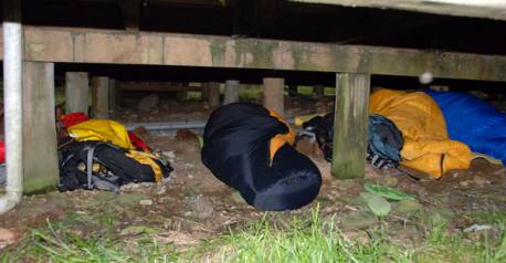
made progress easy over the boggy ground. We
knew that there would be a big crowd at the McKellar Hut, where hikers
congregate from three directions, so Tom struck out to get there quickly.
Arriving only just after 1300, he managed to secure the last two mattresses
in the hut. In the end there were 32 hikers staying at a hut designed for 12.
In fact with the threat of an overnight shower, there were some sleeping
under the hut as well as on its floor! Though it is required to book on
tracks like the Routeburn and Milford, this is not possible on many other
tracks. |
|
|
|
|
|
|
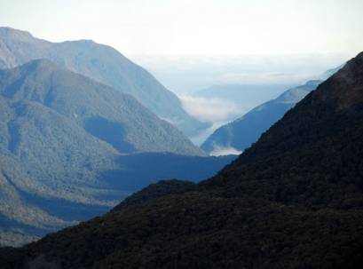
From McKellar it was a short hop to the Howden
Hut, the first on the Routeburn Track itself. We made a short side trip to
Key Summit behind the hut, which gave us a view down the Hollyford Valley and
also showed us that we could expect rain for the rest of the day and
overnight. Though the bunks in the hut were somewhat more
private and comfortable than those in the previous huts, we were plagued by a
group of snorers, all of them Korean. In fact the worst of the group had
volunteered to sleep in the communal area, having been sent to a wood shed at
a previous hut! Fortunately the rain cleared through the following
morning, just in time for us to make a start along a puddled but not muddy
trail. In fact these trails have been so thoroughly maintained that there are
rarely any areas these days, which cause much discomfort unless it has been
pouring for days. Then sometimes
hikers have to be taken out by helicopter. |
|
|
|
|
|
|
|
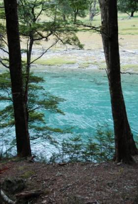
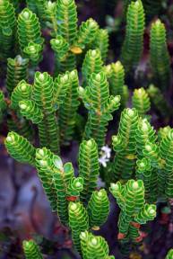
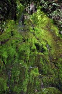
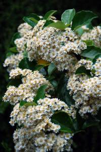
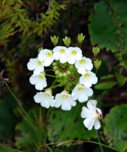
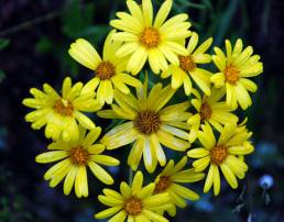
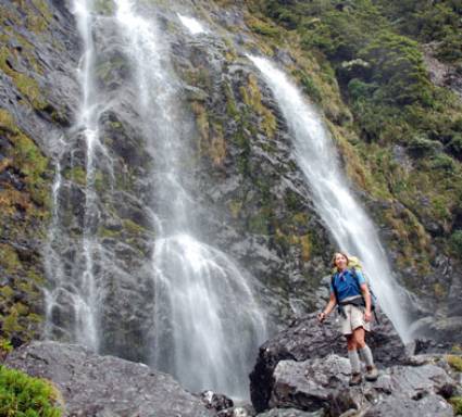
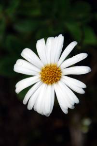
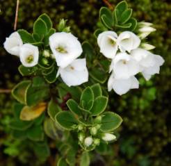
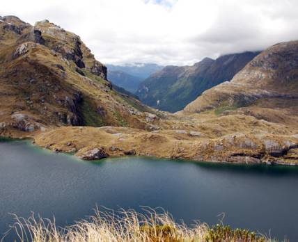
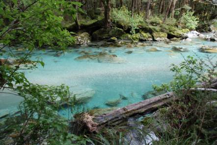
The
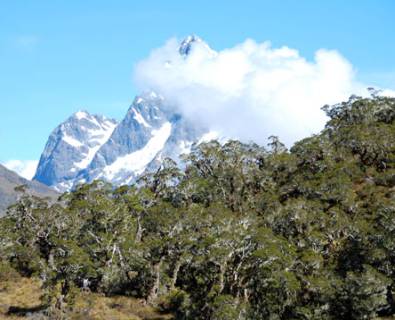
Routeburn Track lies in an area of Fiordland which gets about 7 – 8 metres of
rain a year. There are wonderful waterfalls as well as lush temperate
rainforest and flowers everywhere, from delicate alpine blooms on the open
moorland areas to huge clusters of flowers in the bush and mountain daisies
everywhere. |
|
|
|
|
|
|
|
|
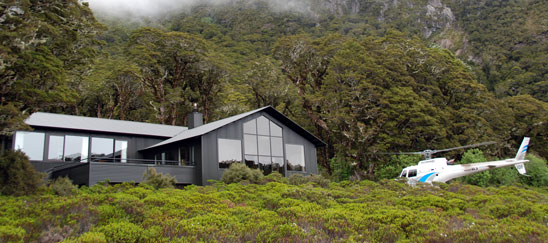
MacKenzie Lake
is the site for both an independent hikers hut and the more palatial lodge
for the guided walkers, whose provisions arrived by helicopter. Some of the hut wardens are real characters and this
was certainly true of the warden at Lake MacKenzie, whose evening talk was
delivered with the East London accent and timing of a Cockney comic and was
just as hilarious. Quite apart from the hiking and scenery, one of
the things we enjoyed most about our stay in the huts was seeing Kiwi
families enjoying being together and sharing the experience of the track. We
met several groups of adults, often with their teenage children, all of them
thoroughly enjoying themselves, with little or none of the conflict and
contention which you so often see. |
|
|

|
|
|
|
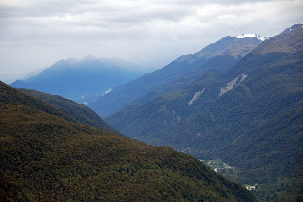
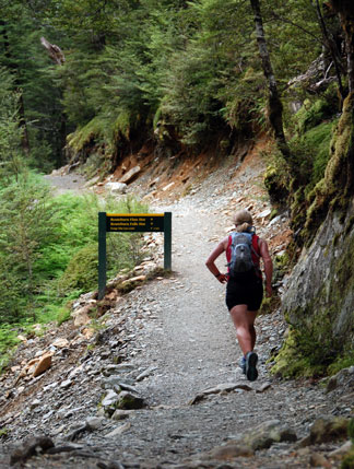
The following day we set off early for the longish
leg to the Routeburn Falls Hut. This part of the track climbs steeply above
Lake MacKenzie to reach the steep slopes which parallel the Hollyford Valley.
The track meanders along these slopes. Early on we were fortunate to have
some wonderful views down the length of the valley all the way to the sea,
but gradually low cloud and mist drifted in as we approached Harris Saddle,
where the track climbs over the ridge line to head down toward the Routeburn
Valley. |
|
|
|
|
|
|
|
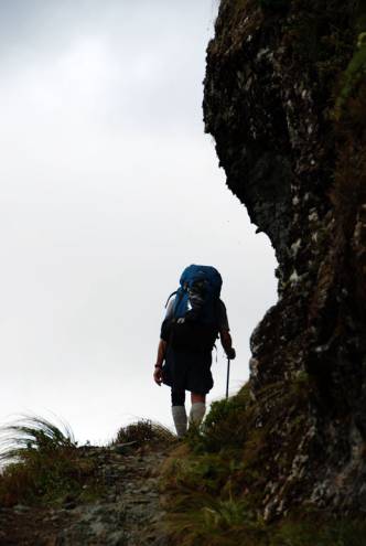
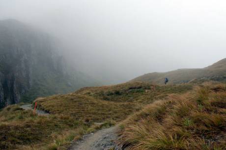
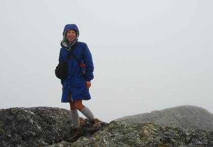
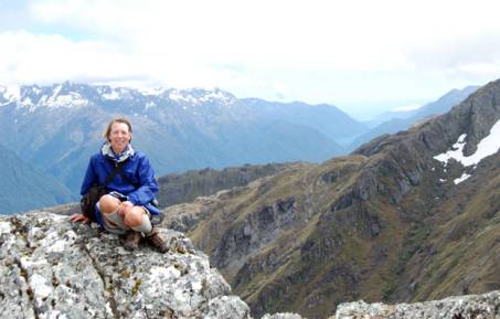
The low cloud and mist was perfect for Tom, who has
a somewhat jaundiced attitude to high open views. However, Vicky was
determined to climb Conical Hill above the saddle and equally determined to
wait for the clearing visibility, which her optimism predicted. She was
rewarded with wonderful views a few hours later. In the meantime, Tom had
taken advantage of the lack of visibility to make his way down to the last Hut,
enjoying the steep, rocky path down and the almost complete lack of 'views'! |
|
|
|
|
|
|
The following day we were back to almost undiluted
sunshine as we hiked the much gentler final leg of the Track through the very
beautiful Routeburn Valley and along the glacial waters of the burn itself. We did feel somewhat – though not too much – shamed
by the sight of one woman out for a casual run up to the Saddle and back! |
|
|
|
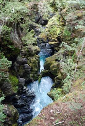
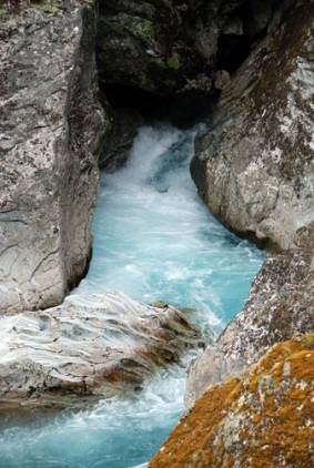
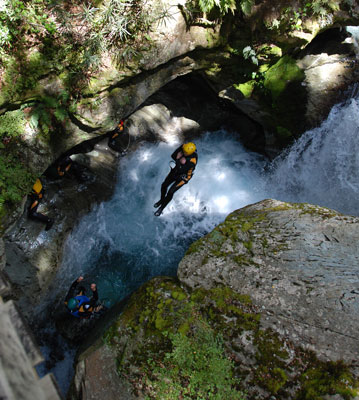
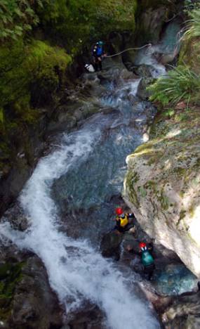
As we made our way down toward the carpark area
where we would catch our bus back to Queenstown, we had our chance to view one
of the many lunatic pursuits listed among the 'extreme sports' opportunities
in the Queenstown area. This is 'canyoning'. Perhaps it is not surprising
that it was developed by a Frenchman, but Fiordland is its main home. It
involves working one's way along a gorge filled with falls, rapids and steep
descents. It is something of cross between rock-climbing, spelunking and
scuba diving. We came away a little unsure of its attractions, even for the
young and foolhardy. |
|
|
|
|
|
|
|
|
|
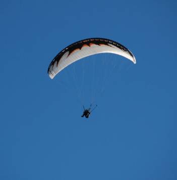
A quiet day of recovery and gentle sight-seeing in
Queenstown preceded our flight back to Auckland. Vicky had hoped to get in at
least one extreme experience before heading back – in this case para-gliding.
However, there was the threat of gusty unpredictable winds in a little front
passing through and so the experience was postponed until another occasion –
perhaps her 80th birthday! |
|
As the previous year when we biked the Central Otago
Rail Trail, we were outstandingly lucky with the weather. But even had the
conditions been less clement we would have thoroughly enjoyed the remarkable
experience of the South Island scenery and sharing that experience with
others, particularly other Kiwis, because it is striking that despite the
presence of so many foreign visitors on the famous Southland trails, the
majority are still New Zealanders, quite rightly enjoying their wonderful
country. |
|
Next |